As mentioned in a previous post Team ElectricBlue will visit Rheinfall and Munot on day one. It may be of interest when make the decision which route is the most energy efficient one, to consult with the new route elevation feature provided by google maps. Although the feature is currently available for the bike tab only, it also might be of interest to electric car drivers. Our example:
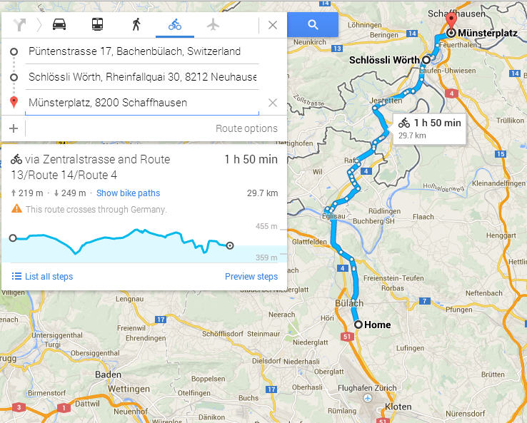
The graph shows that the Münsterplatz in Schaffhausen is just about 30m lower in elevation then our home in Bachenbülach. After a flat 4km slope, there is a first significant decline ( we love regenerative braking ) at the town of Eglisau crossing the river Rhein. Shortly afterwords we will climb to about the same elevation as the start and reaching our highest pike when crossing the border to Germany. We continue virtually flat and will cross the border to Switzerland after a 10 minute drive on German territory. On a steady decline we will reach the Rheinfall at Schlössli Wörth. The last leg starts with a short but steep climb before reaching the Münsterplatz in the center of the old town of Schaffhausen.